Published by Geospectra Geotechnical Pvt. Ltd.
Ground Penetrating Radar (GPR) Survey: Applications, Benefits & Why It's Essential Before Excavation
Before any excavation, trenching, or drilling activity begins, one question matters more than any other: what lies beneath the surface? Underground utilities, old foundations, buried tanks, voids, and reinforcement bars are invisible to the naked eye — yet striking any one of them can cause project delays, safety incidents, and expensive damage. Ground Penetrating Radar (GPR) survey is a non-destructive geophysical method that reveals exactly what is hidden underground, before a single shovel touches the ground.
GeoSpectra provides professional GPR survey services for construction, infrastructure, utility, industrial, and solar projects across India, helping clients dig, drill, and build with confidence and complete subsurface visibility.
What is Ground Penetrating Radar (GPR)?
Ground Penetrating Radar is a non-invasive geophysical survey technique that uses high-frequency electromagnetic waves to create a subsurface image of the ground. A GPR antenna transmits radar pulses into the soil or structure, and the reflected signals are captured and processed to reveal buried objects, utilities, material boundaries, and subsurface anomalies.
Unlike excavation-based investigation methods, GPR survey requires no digging, causes zero ground disturbance, and delivers real-time results directly on site — making it one of the safest and most efficient subsurface detection technologies available today.
How Does GPR Survey Work?
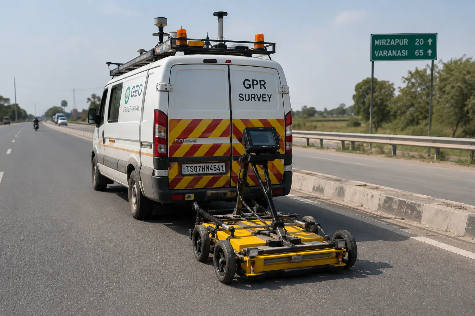
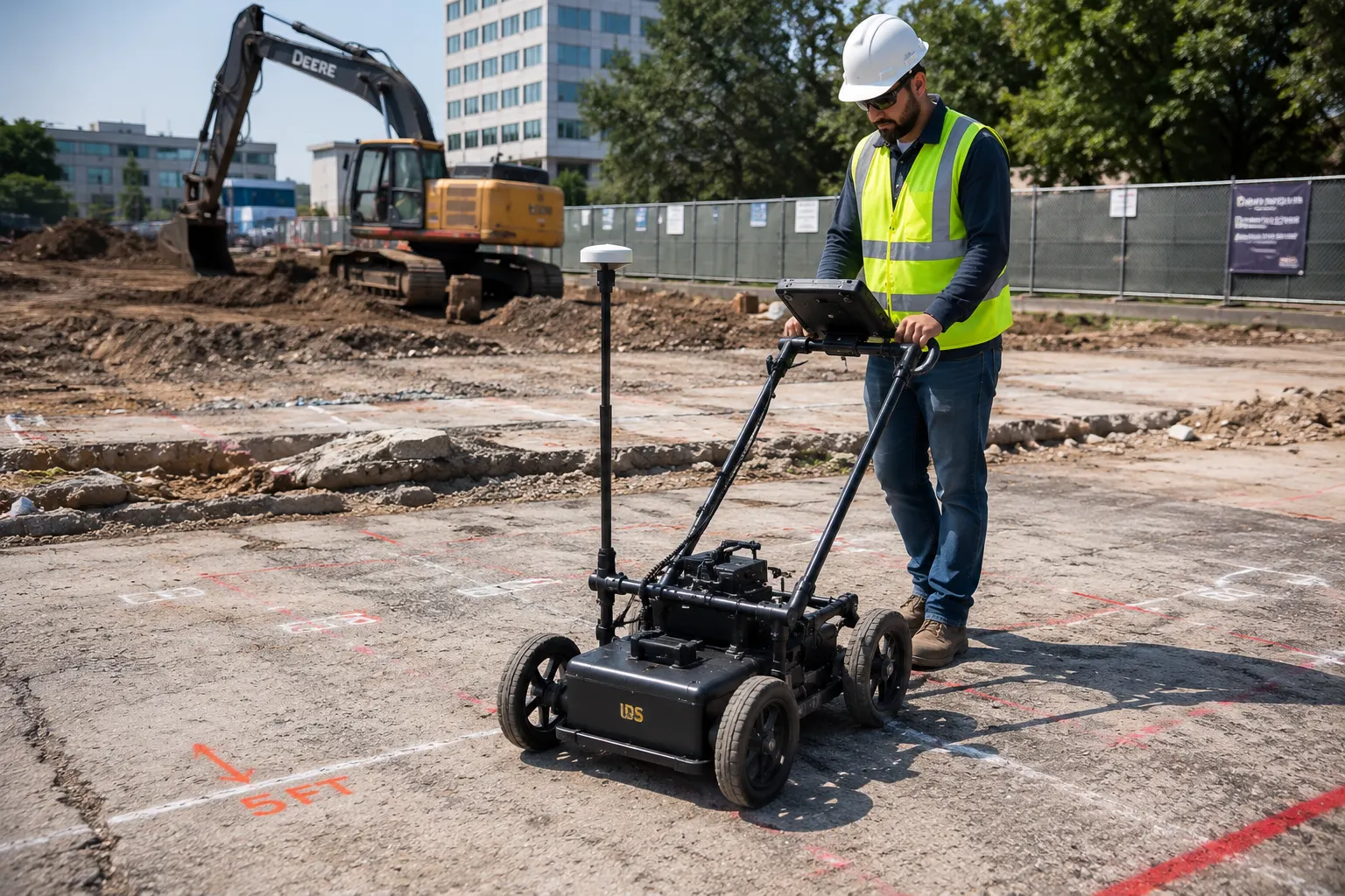
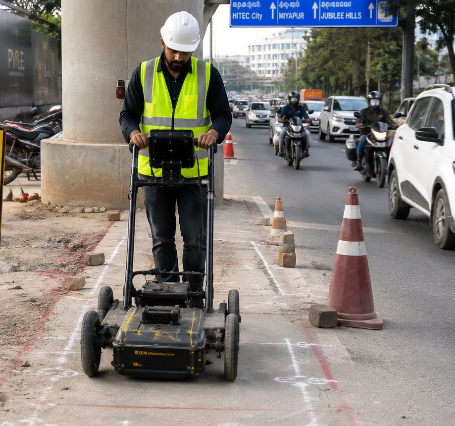
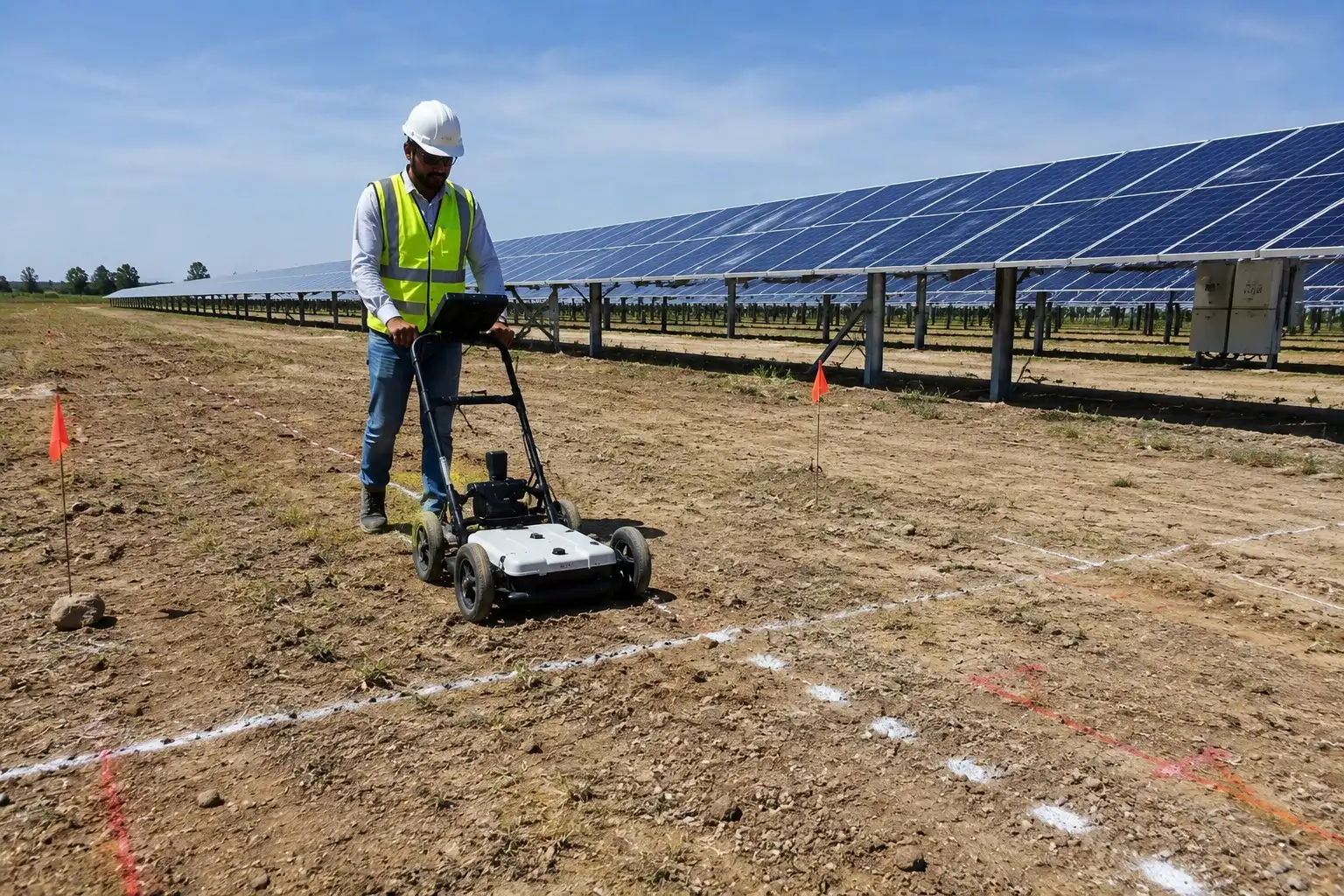
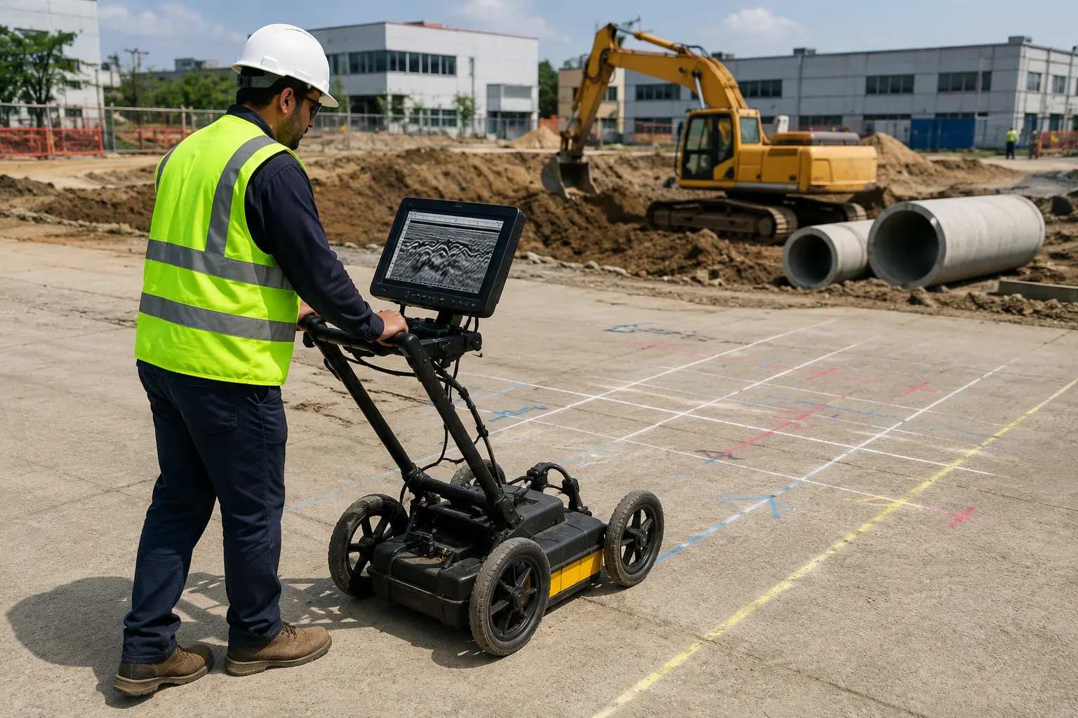
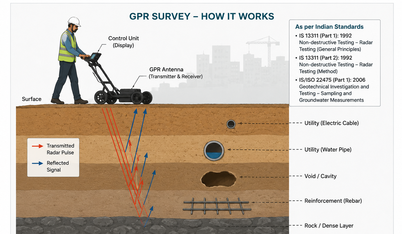
A GPR unit is moved across the survey area in a grid pattern. As radar waves travel into the ground, they reflect back to the antenna whenever they encounter a change in material — such as soil to pipe, soil to void, or soil to rebar. The reflected signals are recorded and converted into a subsurface profile that geotechnical engineers interpret to map utilities, structures, and anomalies with precise depth and location data.
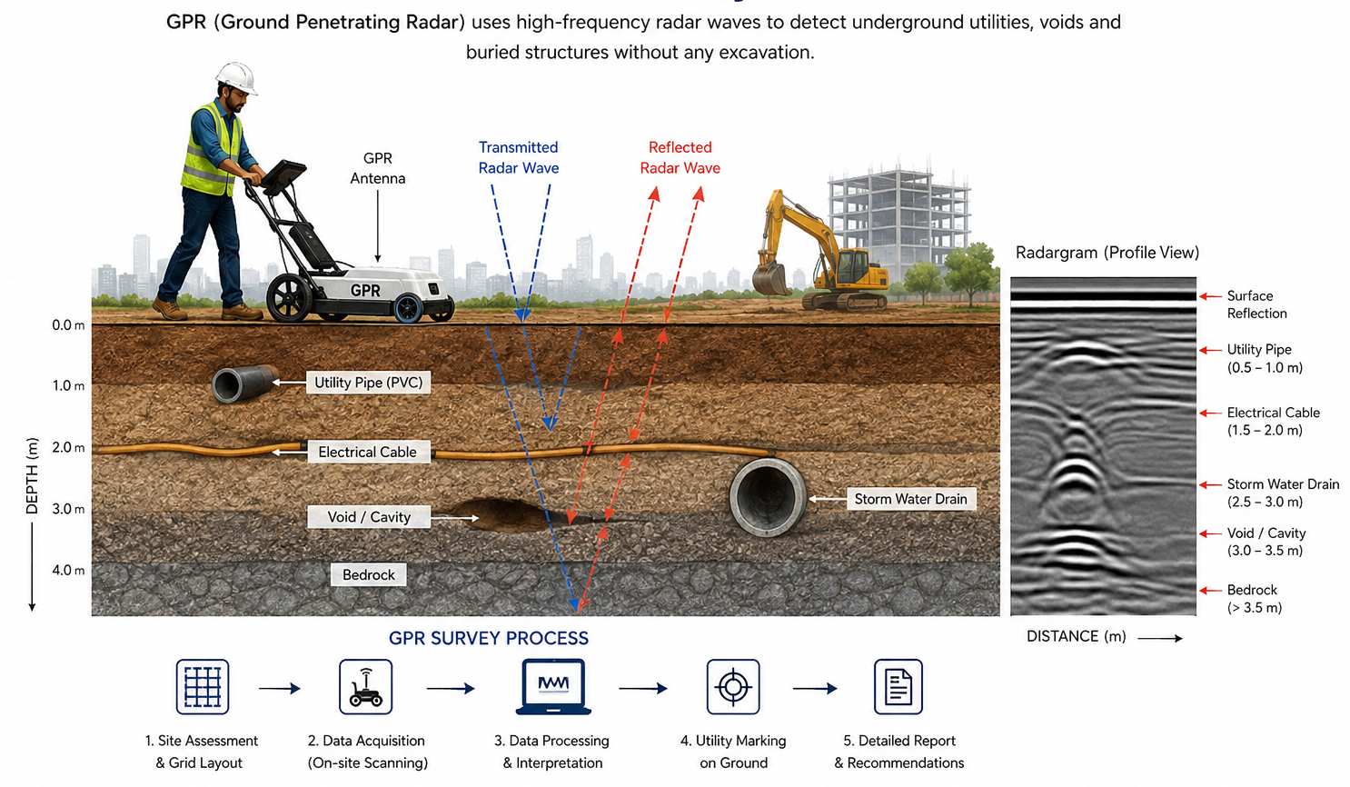
- Radar antenna transmits electromagnetic pulses into the subsurface
- Signals reflect off buried objects, utilities, and material interfaces
- Reflected data is captured and displayed as a real-time subsurface profile
- Engineers interpret the data to mark utility depth, alignment, and material type
Why GPR Survey is Essential Before Excavation
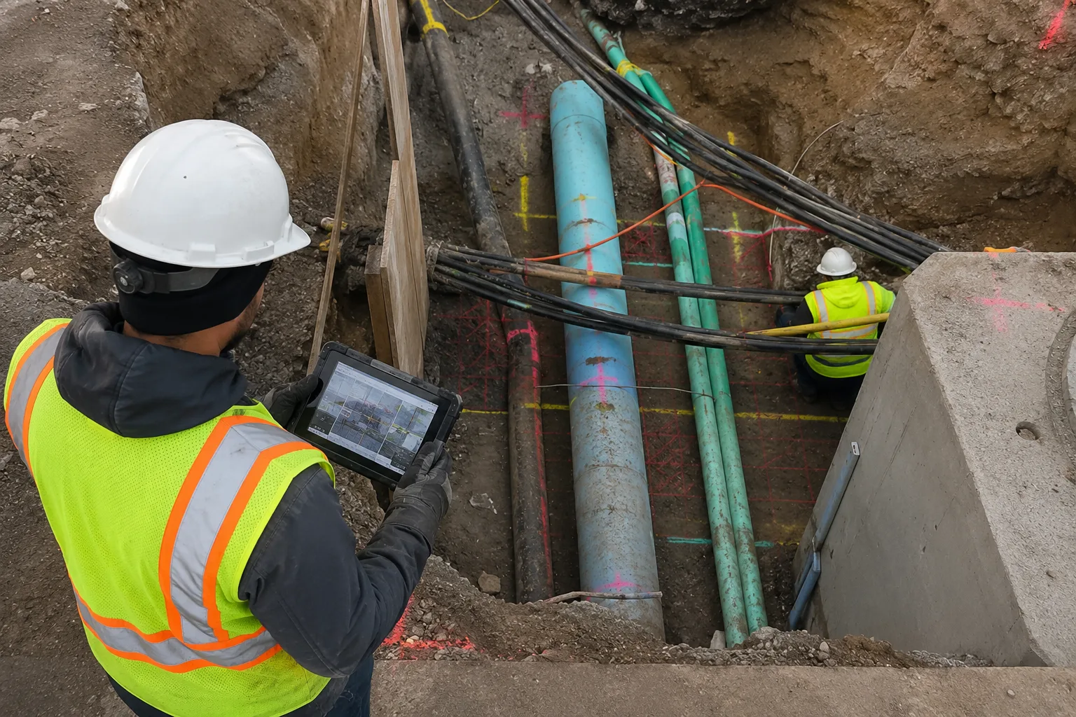
Unplanned excavation without prior subsurface verification is one of the leading causes of utility strikes, project delays, and on-site safety incidents. A GPR survey conducted before excavation removes this uncertainty entirely.
- Prevents accidental utility strikes and service disruptions
- Reduces risk of injury to excavation crews
- Avoids costly project delays and repair expenses
- Ensures compliance with safe digging practices and local regulations
- Protects existing underground assets from damage
- Provides accurate data for excavation planning and permitting
What Can GPR Detect?
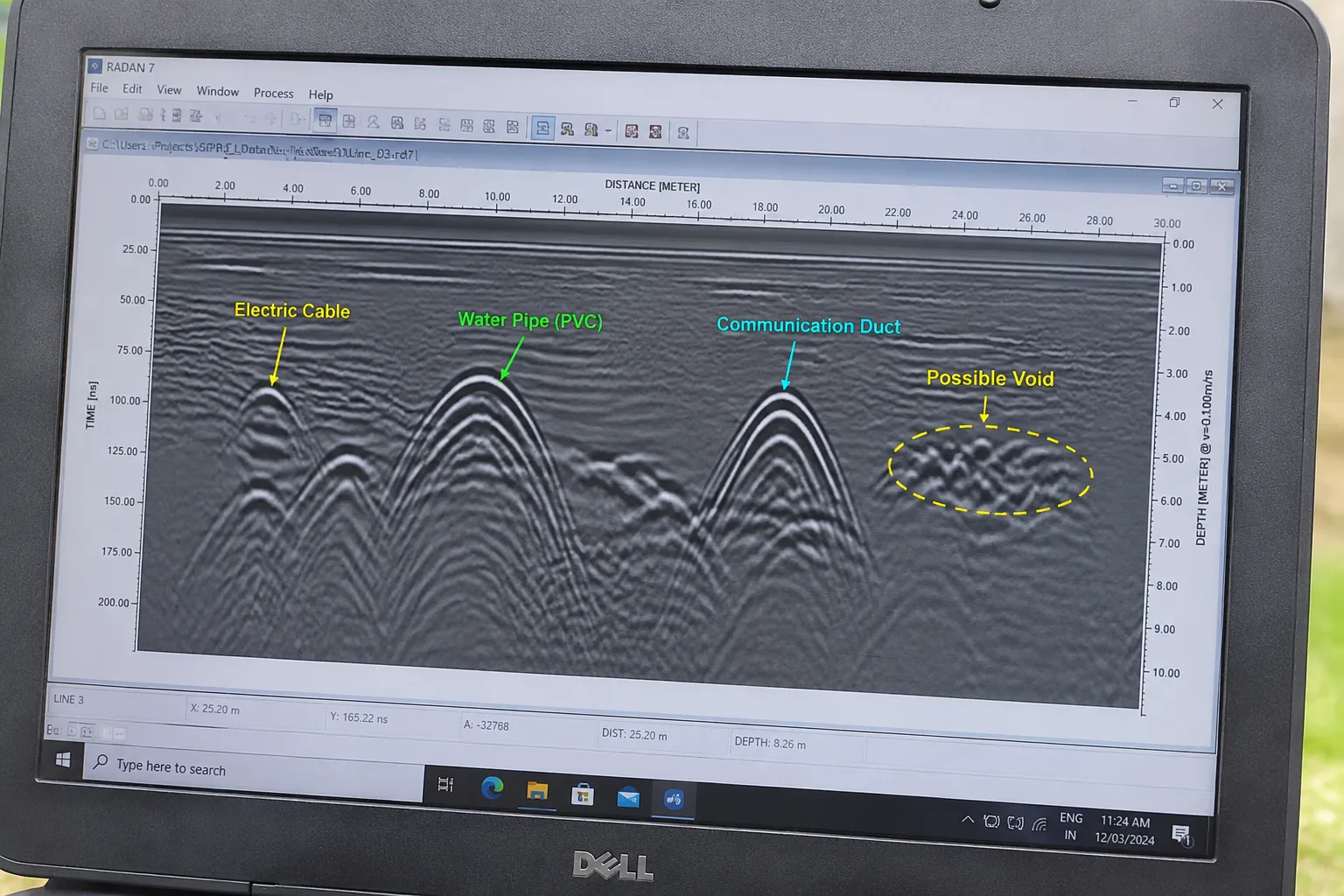
GPR survey is highly versatile and can be used to detect a wide range of buried features and materials, depending on soil conditions and antenna frequency selected.
- Underground utilities — water, drainage, gas, electrical, telecom lines
- Reinforcement bars (rebar) and post-tension cables in concrete slabs
- Underground storage tanks and buried debris
- Voids, cavities, and sinkholes beneath pavements and foundations
- Soil stratification and depth to bedrock
- Old foundations, footings, and abandoned structures
- Groundwater table indications in certain soil conditions
GPR vs Traditional Utility Detection Methods
Compared to traditional methods such as manual trial pits, cable/pipe locators, or relying solely on utility drawings, GPR survey offers significantly greater accuracy, speed, and safety.
- No ground disturbance: unlike trial pits, GPR requires zero excavation
- Detects non-metallic utilities: locates PVC, concrete, and clay pipes that metal locators miss
- Faster coverage: large areas can be scanned in a fraction of the time
- Depth estimation: provides approximate depth of buried features, not just location
- Works on multiple surfaces: soil, concrete, asphalt, and pavement
GPR Survey Process
A typical GPR survey follows a structured, methodical process to ensure accurate and reliable subsurface data.
- Site assessment and selection of appropriate antenna frequency
- Grid marking across the survey area
- Systematic scanning using the GPR unit
- Real-time data capture and on-site verification
- Data processing and subsurface interpretation
- Utility marking and detailed survey reporting
Advantages of GPR Survey
- Completely non-destructive and non-invasive
- Real-time subsurface visualization on site
- Detects both metallic and non-metallic buried features
- Minimizes excavation risk and project downtime
- Cost-effective compared to exploratory excavation
- Improves safety for excavation and drilling crews
- Supports accurate planning, design, and permitting decisions
Applications of GPR Survey Across Industries
- Pre-excavation utility mapping
- Construction and building foundation assessment
- Road and pavement condition evaluation
- Bridge deck and concrete structure scanning
- Solar plant site investigation
- Pipeline and cable route planning
- Rebar and post-tension cable location before core cutting
- Archaeological and heritage site investigation
- Sinkhole and void detection beneath structures
Who Needs GPR Surveys?
Ground Penetrating Radar (GPR) surveys are useful for any project where understanding underground conditions is critical before excavation, construction, drilling, or infrastructure development. From utility detection to structural scanning, GPR helps project teams reduce risk, improve safety, and make informed decisions before starting work.
Construction Companies
Construction companies use GPR surveys before excavation, foundation work, and redevelopment projects to identify hidden underground utilities, buried structures, and potential hazards. Early detection helps prevent unexpected delays, utility damage, and additional project costs.
- Pre-construction underground utility mapping
- Foundation excavation planning
- Detection of buried pipelines and cables
- Concrete scanning before drilling or cutting
Infrastructure Contractors
Infrastructure projects such as roads, highways, bridges, tunnels, and utility corridors require accurate subsurface information. GPR surveys help contractors understand existing underground conditions and plan excavation activities safely.
- Road and pavement investigation
- Pipeline and cable route assessment
- Bridge deck and concrete inspection
- Void and cavity detection below structures
Solar EPC Companies
Solar EPC companies benefit from GPR surveys during solar plant development by identifying underground utilities, buried obstacles, and ground conditions before installation activities begin. This helps avoid construction interruptions and improves project execution.
- Solar plant site investigation
- Underground cable and utility detection
- Foundation and piling area assessment
- Safe planning of equipment installation zones
Industrial & Commercial Projects
Industries, factories, warehouses, and commercial developments use GPR surveys to safely modify existing structures, expand facilities, and avoid damage to hidden underground services.
- Factory expansion projects
- Warehouse and industrial construction
- Existing structure assessment
- Utility mapping in developed areas
Whether you are constructing a new facility, developing infrastructure, or planning excavation work, GeoSpectra's GPR survey services provide accurate subsurface information to reduce risks and support safer project execution.
How to Choose the Right GPR Service Provider
Selecting an experienced GPR survey provider directly affects the accuracy and reliability of your subsurface data. Key factors to evaluate include:
- Experience with varied soil and site conditions
- Availability of multiple antenna frequencies for different applications
- Qualified geotechnical engineers for data interpretation
- Clear, actionable survey reporting with marked utility locations
- Track record across construction, infrastructure, and industrial projects
Quality Control & Reporting in GPR Surveys
Accurate reporting is what turns raw GPR data into a usable excavation-planning tool. Every survey should be backed by careful quality control to ensure the final report reflects real site conditions.
- Cross-verification with available utility drawings and records
- On-site utility marking for excavation teams
- Depth and alignment verification of detected features
- Detailed subsurface report with annotated scan images
- Recommendations for safe excavation zones and clearances
Reliable quality control ensures excavation teams can proceed with confidence and minimal risk of unexpected utility strikes.
Importance of GPR Survey Before Excavation & Construction
Whether you are planning a small utility trench or a large-scale infrastructure project, a GPR survey before excavation is one of the most cost-effective safety and planning investments available. It protects workers, prevents damage to existing utilities, avoids regulatory penalties, and keeps your project on schedule and on budget — making it an essential first step for any responsible excavation or construction plan.